|
Perhaps you are wondering about the detail of information that
Global Discovery could provide you with?
......the maps
below indicate what type of maps and information you would
receive. In addition to this you would get a guide to the depth
counts and quantity of oil recoverable from the field. Further
enlargements will take place on each of the fields then a final
report would be given to the client covering depth, quantity and
quality including gravity weight of oil. Remote surveying can be
done from my base in the UK to discover anomalies within the area
and I can cover many parts of the world as I have already shown
and proven. On Site surveying can be done on mainland and at
sea.
The advantages
of using my technique and surveying will save a considerable
amount of costs because I would be able to indicate which licensed
area would be holding hydrocarbons so that the client does not
waste time and money on a licensed area which may not have any
hydrocarbons or anomalies on it.
My method as a
consultant and advisor and doing the work on site and remotely
helps and at the moment is being used in Kansas USA and is
proving to be successful which means a very happy client.
Partial examples of
the maps you would receive...
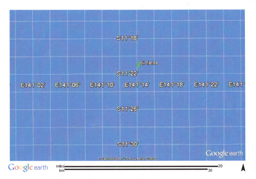
green marker indicating
oil fields.
This is an
example of how I locate an oil field on mainland UK. This map
gives you the co-ordinates in question of the area that the oil
company I helped who confirmed that my findings for oil was
correct from this map and co-ordinates that I gave to them and
that it was financially feasible. Because of red tape the company
decided not to go ahead with this location and they decided to put
all their resources into the West of Shetlands where again I
helped them to locate potential oil fields to which end they have
become successful.
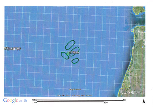
same area enlarged to 80 miles
showing a group of oil fields
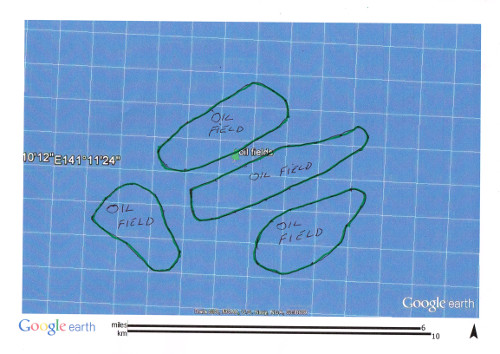
showing the good sized
oil fields with a 6 mile marker on the bottom
But this is
only the start of the information you would have access to upon
commissioning Peter. The maps provided to you would be in much
greater detail going in depth into fractures and faults, zooming
in on maps to show fracture, depths and shatter zones.
These
maps are based on an area that Peter surveyed for his own interest
and thought to be as yet unclaimed by any oil company.
|